
Business Details
Professional Surveying & Town Planning Services
Hille, Thompson and Delfos is a well-established surveying and town planning practice with a strong reputation across the surveying profession, government agencies, and allied industries including architecture, engineering, and real estate. Our team maintains expertise through continuous professional development, attending seminars and workshops to stay current with industry advancements. Equipped with modern computerised surveying tools, GPS technology, and optical instruments, we deliver precise engineering solutions tailored to client requirements. Our office infrastructure features advanced software for creating topographical plans, subdivision designs, and road development packages, ensuring comprehensive project support. We prioritise collaboration with project managers to uphold schedules while maintaining ethical, energetic, and scientific approaches to diverse projects.Accredited to ISO 9001:2015 for quality management and ISO 45001:2018 for occupational health and safety, our practice combines technical excellence with rigorous standards. Our multidisciplinary team handles land development projects from concept to completion, offering statutory approvals, contractor coordination, and project management expertise. Specialising in cadastral, engineering, and mining surveying, we serve urban and rural subdivisions, rezoning initiatives, and infrastructure developments. With a dedicated Map Centre as the sole Landgate and GeoScience agency north of Perth, we provide topographic, cadastral, mining, and hydrographic maps alongside customised digital solutions. Our commitment to innovation and client-focused service delivery has solidified our position as a trusted partner in the Midwest region and beyond.
Services
Cadastral Surveying
Engineering Surveying
Mining Surveying
Town Planning
Topographic Mapping
Subdivision Design
Project Management
Hydrographic Charts
Digital Mapping
Highlights and features
- We maintain ISO 9001:2015 and ISO 45001:2018 accreditations for quality and safety.
- Our team utilises modern computerised surveying equipment and GPS technology.
- We offer multidisciplinary expertise across cadastral, engineering, and mining surveying.
- Our practice has permanent survey teams with continuous professional development.
- We provide tailored mapping solutions through Western Australia's only Landgate agency north of Perth.
Associations and certifications
- ISO 9001:2015
- ISO 45001:2018
Services
Cadastral Surveying
We conduct precise boundary determination and subdivision surveys for rural and urban properties. Our services include rezoning applications, feasibility studies, and WAPC submissions. Our team ensures compliance with legal standards while delivering accurate spatial data for property development projects.
Town Planning
Our multidisciplinary approach covers complete project cycles from concept design to statutory approvals. We specialise in subdivision planning, structure development, and local rural strategies. Our expertise includes coordinating with government agencies and managing development applications across the Midwest region.
Digital Mapping
As the sole Landgate and GeoScience agency north of Perth, we provide topographic, cadastral, and mining maps. Our digital solutions include Streetsmart Tourist Maps, aerial photography, and customised GIS data for infrastructure and resource projects.
Engineering Surveying
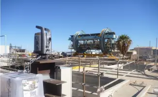
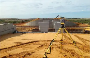
We deliver precise measurements for infrastructure projects using advanced optical instruments and GPS technology. Our services support bridge construction, port developments, and industrial site surveys with accuracy tailored to engineering specifications.
Project Management
We oversee land development projects from initial design through to completion. Our services include contractor coordination, schedule maintenance, and statutory compliance management. Our team ensures efficient project delivery while maintaining high integrity standards.
Questions
What surveying services do you offer in Geraldton?
We provide cadastral, engineering, and mining surveying services including subdivisions, boundary determination, infrastructure projects, and resource sector support across the Midwest region.
Are you accredited for quality and safety standards?
Yes, we hold ISO 9001:2015 certification for quality management and ISO 45001:2018 accreditation for occupational health and safety systems.
Do you provide mapping services?
Our Map Centre offers topographic, cadastral, mining, and hydrographic maps as the only Landgate and GeoScience agency north of Perth.
What town planning expertise do you have?
We handle complete land development projects including subdivision design, rezoning applications, structure planning, and statutory approvals coordination with government agencies.
Which areas do you service?
We primarily serve Geraldton, Dongara, Kalbarri, and the broader Midwest region of Western Australia.