
Business Details
Your Trusted Partner for Professional Surveying Services
Jurovich Surveying stands as Australia's premier survey firm, delivering professional surveying solutions to the construction and land development sectors. With a team of highly skilled, licensed surveyors and cutting-edge technology, we ensure precision and efficiency across projects of all scalesfrom large-scale mining operations to residential developments. Our commitment to excellence is underpinned by over 70 qualified professionals, all members of the Surveying and Spatial Sciences Institute, and licensed practitioners adhering to rigorous industry standards. We prioritise client satisfaction through innovative methodologies, rapid project execution, and a focus on achieving flawless results on the first attempt.Our national presence across Perth, Sydney, Adelaide, and Brisbane enables us to serve diverse regional needs while maintaining consistent quality. Recognised by leading Australian companies for reliability and technical expertise, we continuously invest in staff development and advanced equipment to uphold our market leadership. Transparency, ethical practices, and a dedication to solving complex surveying challenges define our approach, ensuring clients receive unparalleled value and accuracy in every engagement.

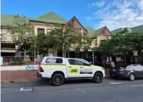
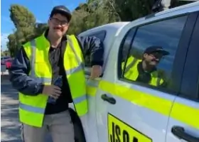
Services
Commercial Surveying
Residential Surveying
Aerial Surveying
Laser Scanning
Hydrographic Surveys
Rail Track Surveys
Utility Mapping
Concrete Scanning
Ground Penetrating Radar
Highlights and features
- We employ over 70 qualified surveyors with national industry expertise.
- Our team uses state-of-the-art equipment for accurate, efficient results.
- Licensed practitioners hold current certifications from regulatory bodies.
- Proven track record with Australia's leading construction and development firms.
- Nationwide coverage with offices in Perth, Sydney, Adelaide, and Brisbane.
Associations and certifications
- Surveying and Spatial Sciences Institute
- Land Surveyors Licensing Board
Services
Aerial Surveying
Our aerial surveying utilises advanced drone technology to capture high-resolution topographic data. This method provides rapid, cost-effective site analysis for large-scale construction and mining projects. Clients benefit from detailed 3D models and accurate measurements without disrupting ground operations.
Hydrographic Surveys
Specialising in underwater terrain mapping, our hydrographic surveys support port developments, dredging projects, and environmental monitoring. Using sonar and GPS systems, we deliver precise bathymetric data to ensure safe navigation and infrastructure planning in marine environments.
Utility Mapping
We locate and map subsurface utilities using ground-penetrating radar and electromagnetic detection. This service prevents accidental damage during excavation while ensuring compliance with safety regulations for urban infrastructure projects.
Rail Track Surveys
Our rail track surveys ensure precise alignment and maintenance of railway infrastructure. Using laser scanning and total stations, we provide data for track geometry optimisation, reducing derailment risks and improving operational efficiency for transport networks.
Concrete Scanning
Using ground-penetrating radar, we identify embedded objects in concrete structures without destructive testing. This service ensures safe drilling and cutting operations for building renovations and infrastructure upgrades across commercial and residential sectors.
People
Brad Jurovich
Director
Brad Jurovich leads strategic growth initiatives, leveraging decades of surveying experience to maintain industry leadership. His focus on innovation and client relationships drives the company's expansion and technical advancements.
Neil Farnsworth
General Manager
Neil Farnsworth oversees daily operations, ensuring project delivery excellence across all regions. With extensive management experience, he maintains rigorous quality standards while fostering team development and client satisfaction.
Andrew Deane
East Coast Operations Manager
Andrew Deane manages eastern seaboard projects, combining technical expertise with operational efficiency. His leadership ensures seamless execution of complex surveys from Queensland to New South Wales.
Gordon Jones
Cadastral Survey Manager
Licensed surveyor Gordon Jones specialises in land boundary determination, providing legally compliant solutions for property developments. His expertise ensures accurate cadastral records aligned with regulatory requirements.
Stephen Murgia
Perth Engineering Manager
Stephen Murgia leads engineering survey projects in Western Australia, applying advanced techniques to infrastructure developments. His technical leadership ensures precision in challenging mining and industrial environments.
Questions
What surveying services does Jurovich offer?
We provide aerial, hydrographic, rail track, utility mapping, and concrete scanning services using advanced technology for construction and land development projects.
Are your surveyors licensed and qualified?
All our surveyors are members of the Surveying and Spatial Sciences Institute with current licenses from relevant regulatory bodies across Australia.
Do you operate nationally?
Yes, we have offices in Perth, Sydney, Adelaide, and Brisbane, serving clients across Australia for all surveying needs.
What industries do you work with?
We specialise in construction, mining, transport infrastructure, and land development sectors, delivering tailored surveying solutions for each industry.
Videos