
Business Details
45 Years
experience
Professional Surveying Services in North Queensland
Rowlands Surveys has been a trusted name in professional surveying services across North Queensland since 1981. Our locally-based teams combine decades of experience with modern technology to deliver precise surveying solutions for projects of all scales. From residential boundaries to major infrastructure developments, our crews operate with the highest standards of accuracy and reliability. With five fully-equipped survey parties and a commitment to ongoing staff development, we ensure every project benefits from technical expertise and regional knowledge. Our quality management system guarantees consistent client satisfaction, while our investment in UAV/drone technology enhances data collection capabilities.We specialise in engineering, boundary, construction, mining, and solar farm surveys, supporting clients from initial design through to completion. Our directors bring over 70 years of combined experience in North Queensland's unique surveying challenges. By maintaining strong local ties and prioritising staff retention, we deliver continuity and familiarity with regional requirements. Our services integrate seamlessly with flow-on consultants, ensuring efficient project timelines through accurate foundational data. This enduring commitment to quality and client collaboration has established Rowlands Surveys as a leader in the industry.
Services
Engineering Surveys
Boundary Surveys
Construction Surveys
Mining Surveys
Solar Farm Surveys
UAV Mapping
Cadastral Services
3D Modelling
Infrastructure Surveys
Land Subdivisions
Details
- Year established: 1981
Highlights and features
- Over 30 years of construction surveying experience in Queensland
- Locally-based crews with regional expertise and continuity
- Five survey parties equipped with mine-compliant vehicles
- Quality management system ensuring consistent deliverables
- Investment in UAV/drone technology for enhanced accuracy
Services
Engineering Surveys
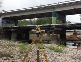
We conduct detailed engineering surveys to map terrain features and existing utilities for infrastructure projects. Our data collection supports accurate design of roads, bridges, and civil works. With 40 years of local experience, we provide reliable baseline information for construction planning.
Boundary Surveys
Our registered cadastral surveyors precisely define property boundaries for residential and commercial land. We handle boundary realignments, subdivisions, and lease surveys with legal compliance. Clients receive certified documentation for land transactions and development approvals.
Mining Surveys
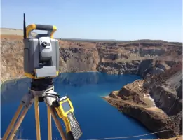
Specialising in mining operations across northwest Queensland, we deliver tenure surveys and infrastructure mapping for mine sites. Our teams have worked at major locations including Osborne and Ernest Henry mines, providing exploration and extraction support since the 1980s.
Solar Farm Surveys
We support large-scale solar developments with site establishment and cadastral surveys. Our work on the 100MW Clare Solar Farm demonstrates our capability to handle complex renewable energy projects from design through construction phases.
UAV Mapping
Our drone fleet captures high-resolution ortho-rectified imagery for 3D models and site maps. This technology enables rapid data collection while maintaining survey-grade accuracy. We integrate aerial mapping with traditional surveying for comprehensive project documentation.
People
Laurie Nolan
Director
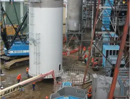
Registered cadastral surveyor with 35+ years' experience in North Queensland. Specialises in mining and commercial projects, including Queensland Nickel plant surveys and Domain Central development. Holds USQ spatial science qualifications.
Paul Hoskins
Director
Surveying associate with 25+ years' field experience. Managing construction surveys for major mines while completing bachelor's degree in Spatial Science. Leads staff development initiatives at Rowlands Surveys.
Ben Cook
Director
Registered surveying associate specialising in infrastructure projects. Experienced in residential subdivisions and high-rise construction. Pursuing cadastral endorsement through USQ external studies while managing field operations.
Questions
What areas do Rowlands Surveys service?
We operate across North Queensland, including Townsville, Mount Isa, Clare, and Normanton regions, with mobile crews ready for remote site deployments.
What surveying technologies do you use?
We combine traditional equipment with UAV/drone technology for aerial mapping, plus 3D modelling and point cloud generation capabilities.
Are your surveyors licensed?
Yes, our directors include registered cadastral surveyors with the Surveyors Board of Queensland, and associates working towards full registration.
Can you handle large infrastructure projects?
Our experience includes 100MW solar farms, mine developments, and commercial infrastructure projects since 1981.
Do you offer construction phase surveys?
We provide complete lifecycle support from design through construction and as-constructed documentation for all project phases.
How do you ensure survey accuracy?
Our quality management system and regular equipment calibration guarantee precise measurements traceable to national standards.