Business Details
19 Years
experience
Expert Land Surveying Services in Sydney
Citisurv was established in 2007 by Mike Morris, building upon the legacy of Starr Surveying (founded in 1972) and Downing Surveyors. Our team of licensed registered surveyors combines decades of industry experience with cutting-edge technology to deliver precise boundary determinations, engineering surveys, and mapping solutions. We serve a diverse clientele including homeowners, developers, architects, and government authorities across New South Wales. Our commitment to technical excellence is matched by our dedication to client collaboration, ensuring every project meets exact specifications while adhering to strict timelines. With advanced equipment like UAV drones, laser scanners, and GPS systems, we maintain industry-leading accuracy.Our staff regularly participate in professional development programs to stay at the forefront of surveying innovations. This combination of heritage expertise and modern methodology enables us to provide cost-effective solutions without compromising quality. We measure success through repeat client engagements and referrals, evidenced by long-standing partnerships with industry leaders who rely on our services for complex developments. Our operational philosophy centers on delivering start-to-finish project support, from initial detail surveys through to final plan registrations.
Services
Boundary Surveys
Subdivisions
Strata Plans
Construction Set Out
Topographic Surveys
Drone Surveys
Floor Plans
Civil Engineering Surveys
Details
- Year established: 2007
Highlights and features
- We offer fast turnaround times without compromising quality
- Our team uses the latest surveying technology for accurate results
- We provide free tailored proposals outlining approach, timelines, and pricing
- With over 50 years of combined experience, we deliver expert surveying solutions
- Our satisfied clients consistently recommend us for professional services
Associations and certifications
- Institute of Surveyors Australia NSW
What people say
Cost-effective, high-quality work
Efficient service
Commitment to excellence
Accurate measurements
Timely delivery
Services
Boundary Surveys
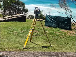
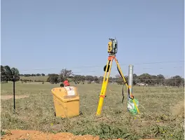
Our boundary surveys precisely determine property lines using advanced GPS and robotic total station technology. This service ensures legal compliance for land transactions, subdivisions, and development projects. Clients receive detailed documentation meeting NSW Land Registry requirements.
Construction Set Out
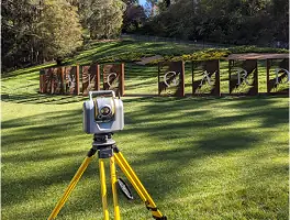
We provide accurate physical marking of building plans on construction sites using laser scanning and total station equipment. This ensures structures are built to exact design specifications. Our services support commercial, residential, and infrastructure projects across NSW.
Drone Surveys
Using UAV technology, we create high-resolution topographic maps and 3D models for land development projects. This cost-effective method captures detailed site data quickly, supporting planning, progress monitoring, and volumetric calculations for large-scale developments.
Subdivision Services
We manage complete subdivision processes from initial detail surveys to final plan registration. Our services include strata plans, lot redefinitions, and compliance documentation for residential and commercial developments across Sydney and regional NSW.
Topographic Surveys
Our topographic surveys capture detailed terrain features using laser scanning and GPS technology. This data supports engineering designs, drainage planning, and development applications. Clients receive accurate digital elevation models and contour maps for project planning.
People
Mike Morris
Principal Director
Mike Morris is the Principal Director and owner of Citisurv with over 30 years of experience. A NSW Registered Land Surveyor and Engineering Surveyor, he specialises in UAV piloting, mining, cadastral, and GPS surveys. Mike is a member of the Institute of Surveyors Australia NSW.
Questions
What surveying services do you offer?
We provide boundary surveys, subdivisions, construction set-out, topographic surveys, drone mapping, strata plans, and engineering surveys across NSW.
How long have you been operating?
Citisurv Pty Ltd was established in 2007, incorporating Starr Surveying Services (founded 1972) and Downing Surveyors.
Do you work outside Sydney?
Yes, we serve Wollongong, Newcastle, Central Coast, Southern Highlands, and regional NSW projects.
What technology do you use?
We utilise Trimble robotic total stations, GPS systems, UAV drones, laser scanners, and CAD software for precise results.
How to request a survey?
Contact us via phone or email to discuss your requirements and receive a tailored proposal with timelines and pricing.
Reviews (3)
Buildlife Projects
Oct 02, 2018
Report
Very happy with the services of Citisurv. The whole team has been outstanding in delivering our projects in Penshurst and Riverwood from start from finish; detail, setout, DP and strata plan. I'd like to thank our surveyor Taha for his professionalism and prompt service. Highly recommend Citisurv as your go-to surveying team.
Bilal Allouche
Jul 19, 2018
Report
Mike from Citisurv is one the best surveyors in the business. He is always very professional, always courteous and willing to go the extra mile. Mike has been there for us in the good and hard times and has never let us down. Big thank you to Mike and the Citisurv team, looking forward to working with you on all my future projects. A+
Andalos Developments
Sep 30, 2017
Report
Our experience with Citisurv has so far been excellent. Ismat has been very responsive and helpful with all our requests and has gone above and beyond to ensure we meet deadlines and that submissions are all done without error or hiccups. Ismat and the Citisurv team are true experts in their field, highly recommend to all builders & developers alike. Look forward to working for years ahead - Alamir Ayoubi