Business Details
50+ Years
experience
Trusted Surveying & Town Planning Services in Sydney
Established in 1971, Project Surveyors has built a reputation as a trusted leader in surveying and town planning across Sydney and Regional NSW. Our team of award-winning professionals combines decades of experience with cutting-edge technology, including ISO 9001-certified processes, to deliver precise and reliable solutions. We specialise in land surveying, 3D laser scanning, BIM/GIS, and expert witness services, ensuring tailored outcomes for developers, property owners, and managers.With a commitment to innovation and client-centric service, we prioritise prompt turnaround times and adherence to evolving regulatory standards, making us the preferred choice for complex projects requiring technical excellence and unwavering accuracy.


Services
Land Surveying
Town Planning
3D Scanning
BIM/GIS
Expert Witness
Details
- Year established: 1971
Highlights and features
- We have over 50 years of experience in NSW surveying and town planning.
- Our team utilises cutting-edge 3D laser scanning and BIM technology.
- We guarantee prompt turnaround times for all surveying projects.
- Our ISO 9001 certification ensures quality management systems.
- Tailored solutions for developers, property owners, and legal professionals.
Associations and certifications
- ISO 9001
What people say
Best quality survey
Top service
Quick response
Professionalism, Quality
Fantastic knowledge
Services
Land Surveying
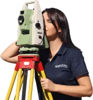
Our land surveying services establish precise property boundaries, building structures, and engineering data. Using advanced tools, we deliver accurate measurements for subdivisions, lease area assessments, and construction projects. Clients benefit from compliance with NSW regulations and decades of technical expertise, ensuring reliable data for legal, development, or infrastructure purposes.
Town Planning
We provide end-to-end town planning services, including development applications, rezoning, and environmental assessments. Our team navigates local government requirements to secure approvals for residential, commercial, and industrial projects. Clients gain strategic guidance on compliance, feasibility, and sustainable land use to maximise project success.
3D Scanning
Our 3D laser scanning captures high-resolution spatial data for heritage sites, construction projects, and asset management. This non-intrusive technology produces detailed point clouds, enabling accurate modelling and clash detection. Clients receive fast, millimetre-precise data to streamline design, renovation, or preservation workflows.
BIM/GIS
We create BIM-ready models and GIS spatial analyses for seamless project integration. Our services support construction, infrastructure, and facility management with data-driven decision-making. Clients benefit from interoperable digital twins, clash detection, and compliance-ready documentation aligned with NSW Spatial Digital Twin initiatives.
Expert Witness
Our expert witness services resolve boundary disputes, easement conflicts, and professional negligence claims. We provide court-compliant reports, site inspections, and testimony grounded in ISO-certified methodologies. Clients receive impartial, technically rigorous evidence to support legal proceedings and dispute resolution.
Questions
Do I need a registered surveyor for my project?
Yes, for NSW land surveys involving boundaries, easements, or subdivisions. Our registered surveyors ensure compliance with legal and regulatory standards.
How much does a survey cost and how long does it take?
Costs and timelines depend on project complexity. Contact us for a tailored quote and transparent breakdown of deliverables.
Can I subdivide my land?
Subdivision feasibility depends on zoning, council policies, and planning laws. Our team guides you through compliance requirements and approval processes.
Do I need a Development Application (DA)?
DA requirements vary by project scale and impact. We assess your needs and manage applications to secure necessary approvals efficiently.
How does 3D laser scanning benefit my project?
It provides millimetre-accurate data quickly, reducing site visits and errors. Ideal for heritage sites, construction, and complex infrastructure projects.
Reviews (3)
Karen Davis
Dec 22, 2021
Report
Positive:Professionalism,Responsiveness
I highly recommend their professional service provided and the quick turn around from start to finish.
I highly recommend their professional service provided and the quick turn around from start to finish.
Kenny Ng
Oct 22, 2021
Report
Project Surveyors is my go to provider and i am happy to share that my experience is everything you would expect from a professional surveyor. what i love most is their ability to offer simple, practical solutions and i i found the team at PS were all passionate about sharing their decades of experiences on the field. honest, consistent and straight forward dealing. Keep up the great work!
Greg Thompson
Oct 16, 2021
Report
Project Surveyors always provide a professional service and expert advice with reasonable fees.
Surveyors of choice for my projects
Surveyors of choice for my projects