
Business Details
22 Years
experience
Professional Surveying Services in Perth
Founded in 2004, Austin Surveys has established itself as a leader in professional surveying services across Western Australia. Our commitment to excellence is rooted in a tradition of integrity, innovation, and technical expertise, ensuring clients receive precise and reliable solutions for their engineering, construction, and land development needs. With a focus on cutting-edge technology and safety, we deliver tailored surveying services that meet the highest industry standards. Our team of licensed professionals brings decades of collective experience, offering comprehensive support from project inception to completion. We prioritise continuous improvement through ongoing training and adoption of advanced methodologies, ensuring operational excellence in every project.Clients benefit from our dedication to transparency, client-centric service, and a proven track record of successful outcomes. Our reputation for reliability and professionalism has been built through consistent delivery of high-quality results, earning the trust of industry partners and repeat clients. By combining historical expertise with modern innovation, we provide surveying solutions that address both current and future challenges in land and infrastructure development.

Services
Engineering Surveys
Aerial Surveys
3D Laser Scanning
Land Development
Subdivisions
Details
- Year established: 2004
Highlights and features
- We have over 20 years of experience in land and engineering surveying.
- Our team utilises cutting-edge 3D laser scanning and UAV technology.
- We guarantee accurate results with a perfect safety record.
- Our project management ensures seamless land development processes.
- We offer tailored solutions for both commercial and residential developments.
What people say
Excellent plans
Prompt approval
Reliable and professional
High standard of service
Helpful and considerate
Services
Engineering Surveys
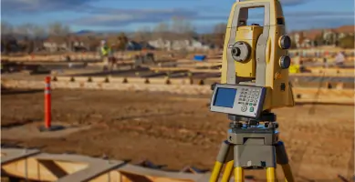
Our engineering surveys provide precise data for infrastructure projects using advanced technology. We specialise in boundary and site surveys, ensuring compliance with regulatory standards. Clients benefit from accurate measurements that streamline construction processes and reduce project delays.
3D Laser Scanning
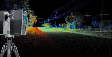
3D laser scanning captures detailed site data at high speed, enabling virtual site tours and accurate modeling. This technology supports design verification and asset management. Clients receive photorealistic point clouds for efficient decision-making without site revisits.
Land Development
We manage land development projects from feasibility studies to final plan lodgement. Our services include topographic surveys and subdivision applications. Clients receive expert guidance through approval processes, optimising lot yield and development efficiency.
Aerial Surveys
Aerial surveys using UAV technology provide comprehensive mapping and inspection solutions. This method ensures rapid data collection for large areas. Clients benefit from high-resolution imagery and cost-effective surveying for infrastructure and environmental projects.
Subdivisions
Our subdivision services cover freehold divisions, strata titles, and land amalgamations. We handle council negotiations and prepare compliant plans. Clients receive sales plans and boundary re-establishment surveys to support property development.
Questions
What surveying services do you offer?
We provide engineering surveys, 3D laser scanning, aerial surveys, land development, and subdivision services.
Do you operate outside Perth?
Yes, we serve regional Western Australia for all surveying needs.
What technology do you use?
We utilise 3D laser scanners, UAVs, and advanced software for accurate data collection and modeling.
How do you ensure project safety?
Our strict health and safety policies ensure zero incidents during all surveying operations.
Can you manage full land development projects?
Yes, we offer end-to-end project management from feasibility studies to final approvals.
Videos