
Business Details
Your Trusted Land Surveying Partner in South Australia
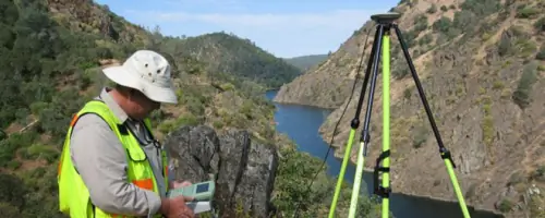
Bleeze Neale & Associates is a South Australian land surveying consultancy with over three decades of experience delivering precise and reliable surveying solutions. Our team of licensed professionals utilises cutting-edge robotic and GPS technology to provide boundary identification, land division, engineering surveys, and development planning services tailored to private, corporate, and government clients. With offices in Gawler and Morphett Vale, we combine technical expertise with local knowledge to ensure projects meet regulatory standards and client expectations.Our commitment to quality is reflected in our certified survey plans, digital documentation, and end-to-end support from project conception to title certification. We prioritise clear communication and technical excellence to deliver actionable data for residential, commercial, and infrastructure developments.


Services
Boundary/Identification Survey
Land Division Survey
Engineering/Detail Surveys
Lease Survey
Planning/Development Applications
Highlights and features
- We have over 30 years of experience in South Australian land surveying.
- Our team uses advanced robotic and GPS instrumentation for accuracy.
- We serve both private and government clients across residential and infrastructure projects.
- All surveys are certified by licensed professionals with local regulatory knowledge.
- We provide end-to-end services from initial planning to title certification.
Services
Boundary/Identification Survey
Boundary surveys clarify property lines using historical records and on-site measurements. We search Lands Titles Office archives, mark boundaries with GPS technology, and produce certified plans. This service prevents encroachments during fencing, construction, or property disputes, ensuring compliance with South Australian land regulations.
Land Division Survey
Land division creates new allotments through boundary realignment or large-scale subdivisions. We advise on approval processes, prepare digital plans, and coordinate with local councils. Our surveys support residential estates, commercial developments, and infrastructure projects, culminating in certified title issuance for new parcels.
Engineering/Detail Surveys
Engineering surveys capture topographic and structural data for construction projects. We map contours, levels, and features in digital formats tailored to client needs. These surveys underpin road design, shopping centre layouts, and residential developments, incorporating underground services and boundary overlays for precise implementation.
Lease Survey
Lease surveys define commercial or industrial lease boundaries according to Property Council of Australia standards. We prepare area calculations and certified plans compliant with Lands Titles Office requirements. This service supports lease agreements, property management, and legal documentation for tenants and landlords.
Planning/Development Applications
Development surveys support planning applications with accurate spatial data. We assess feasibility, prepare digital submissions, and liaise with approval agencies. Our surveys ensure compliance with zoning laws and infrastructure requirements, streamlining approvals for residential, commercial, and public infrastructure projects.
Questions
What is a boundary/identification survey?
A boundary survey clarifies property lines using historical records and on-site measurements to prevent encroachments during construction or fencing.
How does land division work?
Land division realigns boundaries or creates new allotments. We handle council approvals, digital plans, and title certification for residential or commercial developments.
What areas do you service?
We operate across South Australia, with offices in Gawler and Morphett Vale supporting regional and metropolitan projects.
What technology do you use?
We utilise robotic total stations, GPS equipment, and CAD software to ensure precision in all surveying tasks.
Can you assist with development applications?
Yes, we provide survey data and documentation to support planning approvals and compliance with local regulations.