
Business Details
25 Years
experience
Expert Surveying Services in Albury & Wodonga
Established in Albury in 2001, Walpole Surveying has built a reputation for delivering high-quality surveying services using cutting-edge technology. Our team of five licensed surveyors operates across New South Wales and Victoria, serving both private and public sector clients. We specialise in a wide range of projects, from small residential developments to large-scale commercial undertakings. Our expertise extends to complex boundary issues under Old System and Torrens title frameworks, as well as subdivision processes for strata, stratum, and owners corporation arrangements.We are pioneers in aerial mapping using UAV lidar and photogrammetry, complemented by 3D laser scanning capabilities for detailed point cloud data. Affiliated with the Association of Consulting Surveyors and the Institution of Surveyors in both NSW and Victoria, our team brings over a century of combined experience to ensure accurate, reliable, and client-focused solutions. Our commitment to technical excellence and customer service has made us a trusted partner for high-profile projects across the Albury-Wodonga region and beyond.
Services
Cadastral Surveying
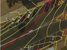
Drone Mapping
Engineering Surveys
Precision Surveying
Project Planning
3D Laser Scanning
Subdivision Services
Boundary Resolution
UAV Photogrammetry
Land Development
Details
- Year established: 2001
Highlights and features
- We have over two decades of combined experience in NSW and Victoria.
- Our team specialises in resolving complex Old System and Torrens title boundaries.
- We lead in UAV lidar and photogrammetry mapping technologies.
- Our 3D laser scanning delivers precise point cloud data for detailed analysis.
- We serve high-profile clients across public and private sector developments.
Associations and certifications
- Association of Consulting Surveyors
- Institution of Surveyors NSW
- Institution of Surveyors Victoria
Services
Cadastral Surveying
We specialise in resolving complex boundary issues for Torrens, Old System, strata, and community title properties. Our services include subdivision planning, easement mapping, and SPEAR applications to ensure legal compliance. With licensed surveyors in NSW and Victoria, we deliver accurate boundary determinations for residential, commercial, and infrastructure projects.
Drone Mapping
Our drone-based mapping services utilise UAV lidar and photogrammetry to create detailed orthophotos and contour maps. Ideal for site analysis, quarry surveys, and low-rise building documentation, this technology provides faster, safer, and more detailed data collection for rural and urban environments across the Albury-Wodonga region.
3D Laser Scanning
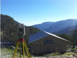
We capture precise 3D spatial data using laser scanning technology to generate point cloud datasets. These can be delivered as raw data or processed into detailed reports and 3D models for construction, engineering, and heritage preservation projects. This non-invasive method ensures millimetre-level accuracy for complex structures and landscapes.
Project Planning
Our team provides feasibility analysis, council development applications, and project management services to optimise land development outcomes. We streamline regulatory processes and coordinate multidisciplinary teams to ensure timely approvals and efficient execution of residential, commercial, and infrastructure projects in NSW and Victoria.
Precision Surveying
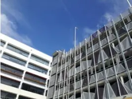
We deliver high-accuracy surveys for construction setout, multi-storey building control, and machine alignment. Our services include monitoring structural deformations, verifying component tolerances, and conducting volume analysis for quarries and stockpiles. These solutions support large-scale developments and industrial projects requiring exacting spatial standards.
Questions
What surveying services do you offer in Albury and Wodonga?
We provide cadastral surveys, drone mapping, 3D laser scanning, engineering surveys, and project planning services for residential, commercial, and infrastructure projects across NSW and Victoria.
How do your UAV mapping services benefit clients?
Our drone-based lidar and photogrammetry technology enables faster, safer data collection with higher detail for site analysis, quarry surveys, and urban development projects in the Albury-Wodonga region.
Are your surveyors licensed in both NSW and Victoria?
Yes, our team includes five licensed surveyors qualified to work across both New South Wales and Victoria, ensuring compliance with state-specific regulations for boundary and development projects.
What experience do you have with complex boundary issues?
With over two decades of combined experience, we specialise in resolving Old System and Torrens title boundary disputes, subdivision processes, and easement mapping for both private and public sector clients.
What technology do you use for land development projects?
We utilise UAV lidar, photogrammetry, and 3D laser scanning alongside traditional surveying methods to deliver precise geospatial data for subdivision, construction, and infrastructure developments.