
Business Details
16 Years
experience
Expert Land Surveying Services in ACT & NSW
Established in 2010, we are a dedicated team of qualified land surveyors serving the Australian Capital Territory and New South Wales regions. Our collective expertise spans over two decades, during which we have consistently refined our methodologies to incorporate cutting-edge technologies and industry advancements. We specialise in delivering precise and reliable surveying solutions tailored to both government and private sector clients across diverse project scales. Our commitment to excellence is reflected in our meticulous attention to detail, ensuring every deliverable meets the highest standards of quality and accuracy.As industry professionals, we uphold values of integrity, transparency, and innovation, which guide our approach to boundary planning, site investigations, and spatial data collection. Our reputation as trusted surveying consultants has been built through consistent delivery of results that form the critical foundation for successful construction, infrastructure, and property development projects.
Services
Boundary Surveys
Topographic Mapping
Engineering Surveys
Construction Surveys
3D Laser Scanning
UAV Drone Surveys
Utility Investigations
Bathymetric Surveys
Commercial Leasing
Residential Development
Details
- Year established: 2010
Highlights and features
- We offer over 20 years of combined surveying expertise.
- Our team prioritises attention to detail in every project.
- We serve both government and private sectors in ACT and NSW.
- We use the latest technology for accurate surveys.
- Established in 2010, we support diverse project sizes.
Services
Boundary Surveys
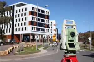
We provide comprehensive boundary marking and subdivision services including deposited plans, unit plans, and lease agreements. Our surveys ensure legal compliance for property development and land management. Our team delivers accurate boundary solutions for both small-scale residential lots and large commercial developments.
Topographic Mapping
Our detailed topographical surveys capture elevation data and surface features in preferred digital formats. These plans support master planning, infrastructure design, and environmental assessments. We use advanced equipment to produce spatially accurate representations for construction and development projects.
Engineering Surveys
We deliver spatially precise surveys for engineering projects with comprehensive metadata. Our services support road design, utility networks, and structural developments. The data we collect forms the critical foundation for engineering designs and construction documentation across public and private sectors.
UAV Drone Surveys
Our drone technology enables efficient site monitoring and terrain modelling through ortho-rectified imagery. We offer hybrid solutions combining ground and aerial surveys for comprehensive data collection. This approach provides cost-effective options for large-scale projects and difficult-to-access areas.
Bathymetric Surveys
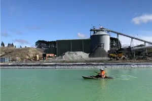
We conduct echo sounding surveys to create underwater contour maps and digital terrain models. Our services support water infrastructure projects and environmental monitoring. Specialised equipment ensures accurate data collection for reservoirs, rivers, and coastal developments.
Questions
What surveying services do you offer?
We provide boundary surveys, topographic mapping, engineering surveys, UAV drone services, bathymetric surveys, and commercial/residential development support.
Which areas do you service?
Our primary service areas include the Australian Capital Territory and New South Wales regions.
How experienced is your team?
Our surveyors have over 20 years of combined industry experience supporting diverse projects since 2010.
What technology do you use?
We utilise GNSS systems, 3D laser scanning, UAV drones, and RTK surveying equipment for accurate data collection.
Can you handle large-scale projects?
Yes, we support both small and large-scale developments across residential, commercial, and government sectors.
How do I request a quote?
Contact us via phone at 02 6296 4089 or through our website's online form to discuss your project requirements.
Reviews (1)
Jarek Miliszewski
Nov 25, 2020
Report
Positive:Professionalism,Quality,Responsiveness,Value
Jason Steger and team supplied our boundary survey, site pegging and supporting site sketch. The team was friendly, professional, on-time, and well priced. Highly recommended.
Jason Steger and team supplied our boundary survey, site pegging and supporting site sketch. The team was friendly, professional, on-time, and well priced. Highly recommended.