
Business Details
9 Years
experience
Professional Land & Engineering Surveyors in Perth
Established in 2017 by Jake Lampard, LPD Surveys has grown from a local Mandurah operation to a multi-office team serving all of Western Australia. Our expertise spans engineering, construction, mapping, infrastructure, UAV, laser scanning, spatial modelling, mining, land development, and dilapidation surveying. With senior licensed surveyors like Sam Keenan, Jake Lampard, and Victor Smith leading projects, we combine over 80 years of collective experience to deliver precise, client-focused solutions. We specialise in integrating advanced technologies such as 3D reality capture and UAV aerial surveys to meet complex project demands. Our commitment to quality is reflected in our ISO-compliant HSEQ system and partnerships with tier 1 contractors and mining companies.We prioritise clear communication, offering a cloud-based portal for real-time project collaboration. Our teams deep local knowledge and technical proficiency ensure compliance with regulatory standards while exceeding client expectations across residential, commercial, and industrial sectors. From small subdivisions to large-scale infrastructure, we provide tailored surveying services that balance innovation with reliability. Our dedication to mentoring cadet surveyors and maintaining cutting-edge equipment underscores our position as a trusted leader in spatial solutions across Australia.
Services
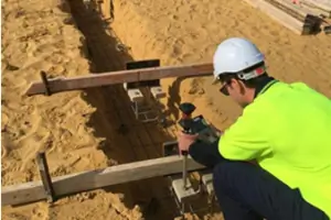
Land Surveying
3D Reality Capture
UAV Aerial Surveys
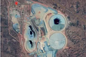
Mining Surveying
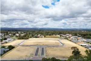
Land Development
Details
- Year established: 2017
Highlights and features
- We offer 15+ years of experience in licensed surveying with advanced 3D technology.
- Our team includes senior surveyors with expertise in mining, infrastructure, and land development.
- We provide real-time project collaboration via a secure cloud-based portal.
- Our ISO 9001-compliant HSEQ system ensures quality and safety standards.
- We deliver tailored solutions for subdivisions, UAV surveys, and complex engineering projects.
Associations and certifications
- ISO 9001
What people say
Accurate surveying
Timely results
Expert subdivision advice
Advanced technology
Clear communication
Services
Land Surveying
LPD Surveys provides precise cadastral and engineering land surveys for subdivisions, boundary identifications, and urban planning. Our services support residential, commercial, and industrial projects with accurate spatial data. We utilise total stations, RTK GPS, and laser scanning to ensure compliance with regulatory standards.
3D Reality Capture
Our 3D reality capture services use terrestrial laser scanning and UAV photogrammetry to create detailed BIM models and digital twins. These solutions aid infrastructure planning, heritage preservation, and construction validation. Sub-centimetre accuracy ensures reliable data for engineering and architectural applications.
UAV Aerial Surveys
We deploy drones for aerial surveys, generating high-resolution topographic maps, stockpile volumetrics, and site progress monitoring. UAV technology enables efficient data collection for mining, agriculture, and large-scale developments. Our pilots hold CASA certifications for safe and compliant operations.
Mining Surveying
LPD Surveys supports mining operations with exploration surveys, pit optimisation, and infrastructure monitoring. Our team uses advanced software like Surpac and Vulcan for resource estimation and haul road design. We ensure compliance with DMIRS tenement requirements and safety protocols.
Land Development
We manage land development projects from feasibility studies to final plan lodgement. Services include subdivision design, drainage surveys, and strata title creation. Our expertise in WA planning regulations streamlines approvals for greenfields estates and urban infill projects.
People
Sam Keenan
Director / Senior Licensed Surveyor
With 17 years of experience, Sam specialises in remote mining and infrastructure projects. He manages teams across WA, NSW, and SA, delivering surveys for BHP, CPB, and Downer Group. He holds a Curtin University degree and is a registered surveyor in NSW.
Jake Lampard
Survey Manager / Senior Licensed Surveyor
Jake founded LPD Surveys in 2017 after 15 years in remote WA and NT projects. He oversees cadastral subdivisions and UAV operations, mentoring cadets toward licensing. His work includes BHP Billiton resource evaluations and FMG rail construction surveys.
Victor Smith
Senior Licensed Surveyor
A Curtin graduate since 1985, Victor has 35+ years of experience in high-rise developments and strata conversions. He advises clients on land development and mentors articled surveyors. His career includes projects for Busselton Health Campus and Sky One Seven Apartments.
Cameron
Senior Surveyor / UAV Specialist
Cameron leads 3D reality capture projects using photogrammetry and lidar. With 12 years of experience, he produces survey-grade models for mining audits and structural set-outs. He holds a RePL and ReOC certification for drone operations.
Brian
Senior Mining Surveyor
Brian has 20+ years in mining surveying, working with Rio Tinto and FMG. He specialises in Surpac/Vulcan software, UAV processing, and underground service detection. His FIFO experience includes open-pit and underground operations across WA and the NT.
Questions
What services does LPD Surveys offer?
We provide land surveying, 3D reality capture, UAV aerial mapping, mining surveys, and land development consultancy across Western Australia.
Are your surveyors licensed in WA?
Yes, our directors and senior staff hold active licenses with the WA Land Surveyors Licensing Board and CASA UAV certifications.
Do you work on remote projects?
Yes, our team has extensive experience in remote mining and infrastructure projects across WA, SA, and the NT.
How do you ensure survey accuracy?
We use calibrated Leica/Trimble equipment, ISO 9001-compliant QA processes, and sub-centimetre laser scanning for precision.
Can you assist with subdivision approvals?
Yes, we manage subdivisions from feasibility studies to Landgate lodgement, ensuring compliance with WA planning regulations.
What industries do you serve?
We work with mining companies, construction firms, local governments, and residential developers on projects ranging from small lots to greenfields estates.
Videos