
Business Details
35 Years
experience
Emergency
services
Professional Surveying and Land Development Services
Established in 1991, Barry Hunt Associates has built a reputation as a trusted provider of professional land surveying and development consultancy services across the Central Coast region. Our team of registered surveyors combines decades of local experience with advanced technical expertise to deliver precise and reliable solutions for residential, commercial, and infrastructure projects. We specialise in detail and contour surveys, building setouts, subdivisions, engineering surveys, and infrastructure monitoring, ensuring compliance with regulatory requirements and project specifications. Our commitment to accuracy is demonstrated through the use of cutting-edge technology and methodologies, including hydrographic surveying for waterways and dam monitoring. We provide end-to-end support from initial planning and development applications to final certification, with a focus on client collaboration and project-specific requirements.Our services extend to both private clients and public sector organisations, including Central Coast Council, where we conduct volume calculations for waste management facilities. With 24/7 availability for urgent projects and nightworks capability, we ensure timely delivery without compromising quality. Our team maintains accreditation as hydrographic surveyors and adheres to strict professional standards, offering clients confidence in the integrity of our work. We prioritise clear communication throughout the surveying process, providing detailed reports that clarify boundaries, structures, and compliance status. Our experience in subdivision projects includes comprehensive planning advice, boundary marking, and registration with Land NSW. By maintaining a client-centric approach, we aim to simplify complex land development processes while upholding the highest levels of technical proficiency and service excellence.
Services
Detail Surveys
Contour Surveys
Building Setouts
Subdivisions
Engineering Surveys
Infrastructure Monitoring
Hydrographic Surveying
Dilapidation Reports
Development Applications
Boundary Marking
Details
- Year established: 1991
Highlights and features
- We have over 30 years of local surveying experience since 1991
- Offer full-service subdivisions from planning to Land NSW registration
- Utilise advanced technology for accurate hydrographic and infrastructure surveys
- Provide 24/7 availability for urgent project requirements
- Maintain accreditation as hydrographic surveyors with specialist dam monitoring skills
Associations and certifications
- Registered Surveyors
- Accredited Hydrographic Surveyor
Services
Detail and Contour Surveys
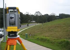
We conduct detailed topographic surveys showing land shape, built improvements, utilities, and notable trees. These surveys support architectural design and civil engineering projects by providing accurate elevation data and spatial relationships. Our team uses advanced equipment to ensure precision for residential and commercial developments.
Building Setouts
Our surveyors mark building corners and offsets to translate construction plans to physical sites. This service ensures correct positioning for new buildings, renovations, and earthworks. We provide boundary-referenced reports confirming compliance with approved plans and regulatory requirements for development applications.
Subdivisions
We manage subdivision projects from initial planning advice to registered plans with Land NSW. Our services include lot yield analysis, boundary marking, and preparation of certified documentation. We handle council development applications and final registration processes to ensure legal compliance and accurate land division.
Engineering Surveys
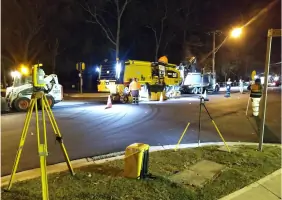
Our team provides construction setout services for roads, drainage, and civil works. We offer work-as-executed certification at critical stages and monitor infrastructure compliance. With nightworks capability, we support urgent projects while maintaining accuracy in road, bridge, and railway developments.
Infrastructure Surveys
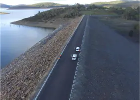
We specialise in monitoring water dams, water supply systems, and other infrastructure for compliance and safety. Our surveys track structural movement and dilapidation, providing critical data for maintenance and regulatory reporting. As accredited hydrographic surveyors, we map rivers and waterways for environmental and engineering purposes.
Questions
What surveying services do you offer?
We provide detail surveys, building setouts, subdivisions, engineering surveys, infrastructure monitoring, hydrographic surveying, and dilapidation reports for residential, commercial, and public projects.
Do you handle subdivision projects from start to finish?
Yes, we manage subdivisions from initial planning advice and development applications through to boundary marking and final registration with Land NSW.
Are your surveyors accredited for specialised work?
Our team includes Accredited Hydrographic Surveyors with specialist skills in dam monitoring and waterway mapping for infrastructure projects.
Can you assist with urgent surveying requirements?
We offer 24/7 availability for urgent projects, including nightworks capability to support critical construction and infrastructure monitoring needs.
What areas do you service?
We primarily serve the Central Coast region, including Tuggerah, with surveying solutions tailored to local land development requirements.